Elevation-Derived Hydrography for the USGS
Elevation-Derived Hydrography for the USGS
Delivering Accurate, Scalable Hydrography for Nationwide Water Data Consistency
For decades, national hydrography mapping relied on manually created datasets that struggled to keep pace with changing landscapes and growing data demands. To improve better flood prediction, infrastructure planning, and environmental decision-making, the U.S. Geological Survey (USGS) began shifting to an elevation-driven approach that more accurately reflects how water moves across the land. Merrick is supporting this shift by helping lay the groundwork for scalable, elevation-derived hydrography.
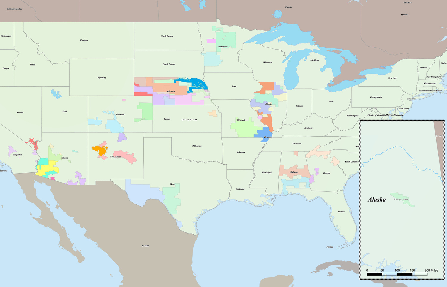
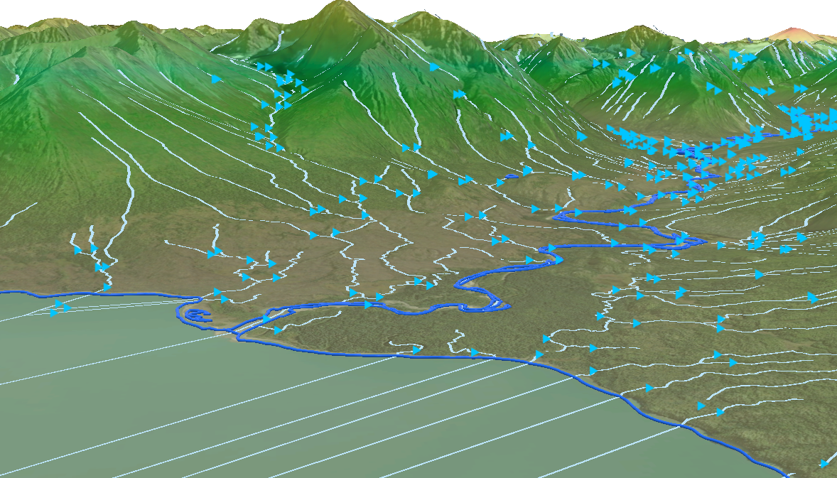
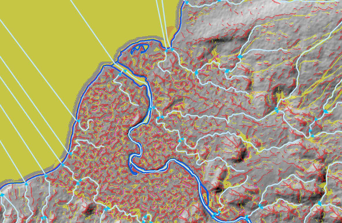
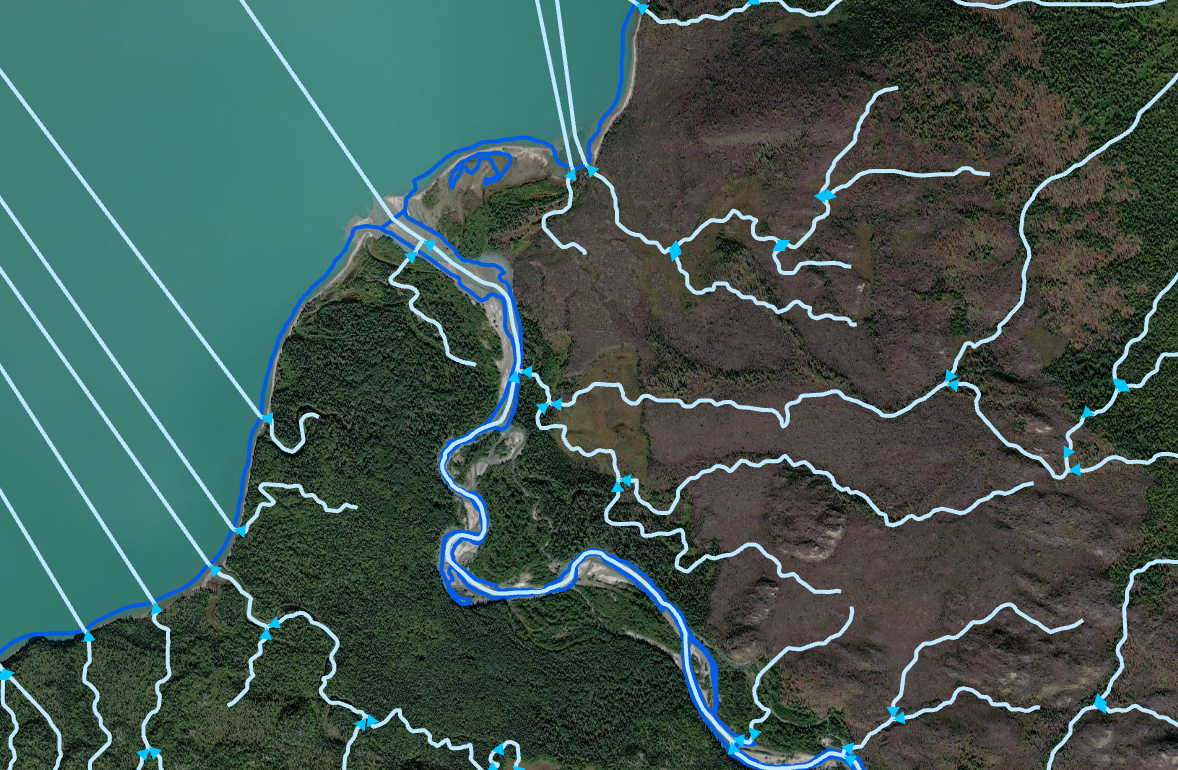
Through the Merrick-Surdex Joint Venture (MSJV) Merrick supports the USGS 3D Hydrography Program by delivering Elevation-Derived Hydrography (EDH) to strengthen the National Hydrography Dataset. Using elevation data from the 3D Elevation Program (3DHP), our team has transformed detailed terrain models into accurate, consistent representations of flow paths and water features. These projects give USGS more reliable data that can be produced at scale and used with confidence across the country.
Merrick’s contributions were especially valuable during early EDH efforts when technical standards were still evolving. Rather than waiting for finalized guidance, we collaborated closely with USGS hydrography and technical teams to interpret emerging requirements, refine workflows, and solve data challenges as they emerged.
Throughout the program’s development, Merrick has consistently delivered EDH products that helped establish a repeatable production model, supporting the long-term program success of the USGS 3D Hydrography Program.
Project Highlights:
- Collaborated with USGS teams during early implementation to interpret evolving technical standards and refine production workflows.e beyond one-off updates and toward a long-term, reliable system.
- Has completed projects and continues to support EDH and 3DHP as integrated efforts to help USGS move beyond one-off updates and toward a long-term, reliable system.
- Several successfully delivered EDH products that strengthened the National Hydrography Dataset using 3D Elevation Program data.
- Worked effectively with lower-resolution (QL5) elevation data, allowing USGS to expand EDH and 3DHP coverage without waiting for higher-resolution data. expand coverage without waiting for higher-resolution data.
- Helped establish a repeatable, scalable EDH production model that continues to support USGS program objectives.
Services:
- Aerial Lidar & Imagery
- Geospatial
- GIS & Spatial Analysis
Make Your Next
Project a Success.
Partner with Merrick.