National Scale Lidar for the USGS 3DEP Program
National Scale Lidar for the USGS 3DEP Program
Delivering Standards-Based Lidar Data for a National Elevation Framework
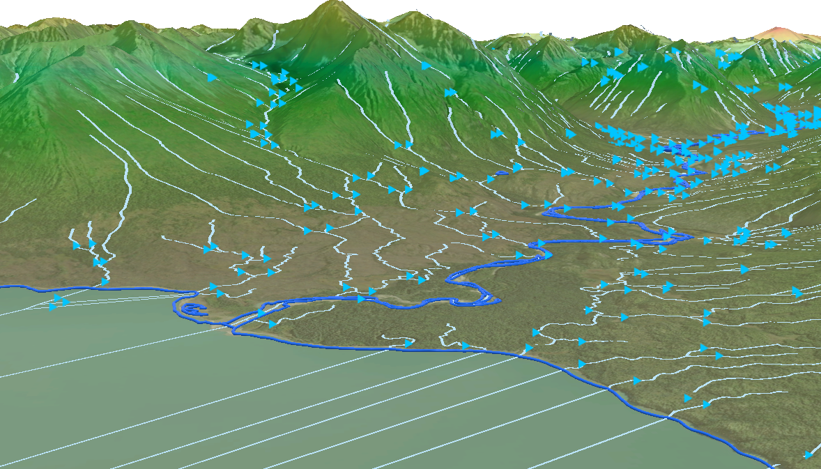
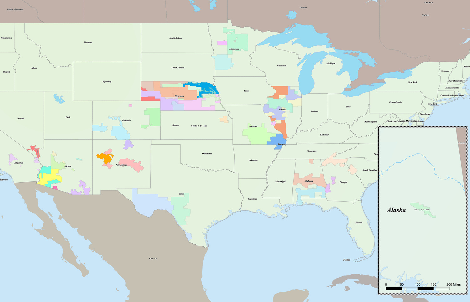
The U.S. Geological Survey’s (USGS) 3D Elevation Program (3DEP) is a nationwide initiative to create consistent, high-resolution elevation data for the United States. Using lidar, 3DEP delivers an accurate three-dimensional representation of the earth’s surface that supports flood risk mapping, infrastructure planning, watershed analysis, natural resource management, hazard mitigation, and land-use decision-making at federal, state, and local levels. By establishing standardized data quality and coverage, 3DEP replaces fragmented or outdated elevation datasets with a trusted foundation agencies can use confidently across programs and jurisdictions.
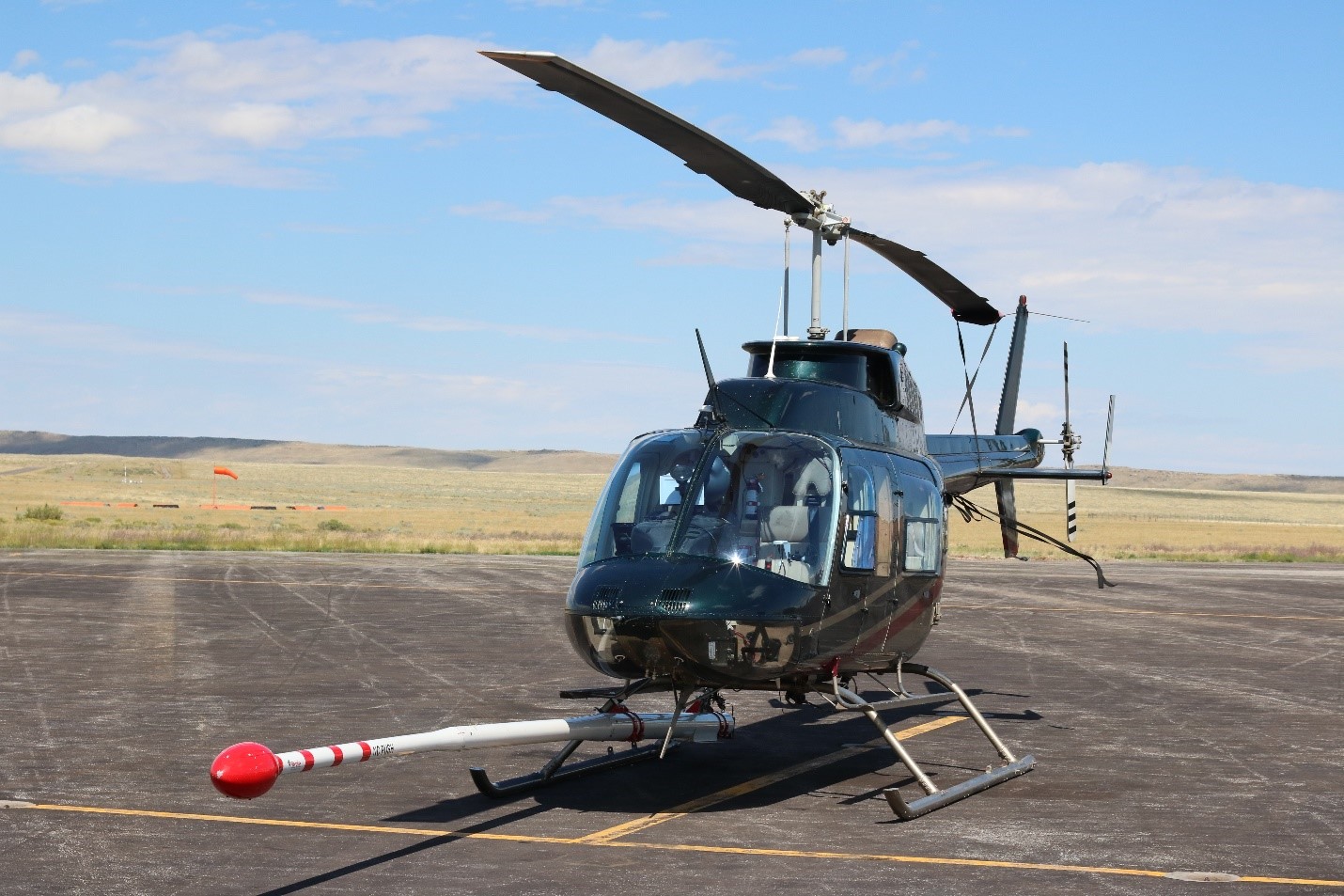
Through the Merrick-Surdex Joint Venture (MSJV), Merrick supports 3DEP by delivering lidar datasets that meet the program’s strict technical and quality requirements. Across numerous task orders under multiple rounds of the Geospatial Products and Services Contracts, Merrick provides seamless, end-to-end 3DEP delivery—from flight planning and airborne lidar acquisition through processing, classification, and final dataset acceptance. Robust ground control, calibration, and verification procedures ensure data accuracy, completeness, and defensibility. All deliverables are designed to integrate smoothly into USGS systems and downstream workflows.
The result is high-confidence elevation data that consistently passes rigorous review and supports timely, informed decision-making at a national scale.
Project Highlights:
- Executes wide area lidar acquisitions during tightly constrained leaf-off, snow-free conditions to meet USGS accuracy and completeness standards.
- Produces highly detailed, standards-based lidar point clouds and elevation products that consistently pass USGS QA/QC with minimal revisions.
- Delivers analysis-ready elevation data for seamless integration into the National Map and downstream federal, state, and local workflows to maximize reuse and long-term return.
Services:
- Aerial Lidar & Imagery
- GIS & Spatial Analysis
Make Your Next
Project a Success.
Partner with Merrick.