Your Trusted Partner for Transmission Line Mapping
Accurate power transmission line mapping is essential to maintaining your distribution infrastructure and providing uninterrupted power to your customers. We’ll partner with you to create highly accurate mapping datasets. We also offer in-house data processing and management services to give you peace of mind about the security of your data. Our mapping experts have provided remote sensing, surveying, and mapping for tens of thousands of miles of power infrastructure across the United States, including route/corridor projects and substation projects. We’ll help you maintain and access your data easily so you can visualize up-to-date information about your infrastructure like load management, hazardous points, power demand, outage information, and more. Using this data, we’ll also help you identify network efficiencies and future opportunities for expanding your assets.
We offer you comprehensive transmission line
mapping services.
Lidar Capture & Corridor Mapping
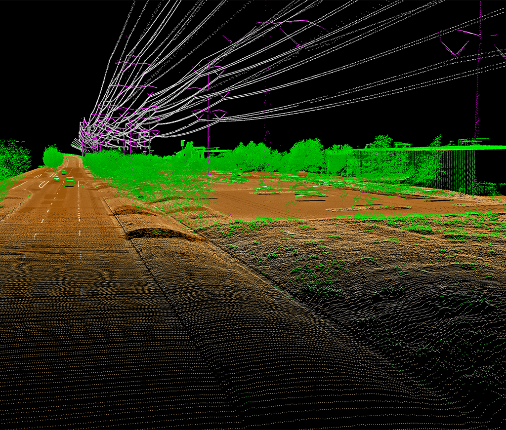
Using cutting-edge lidar technology, we provide highly accurate and timely surveys of your current infrastructure. Whether you’re looking to expand your infrastructure or simply mapping to build a database of your assets, we have the right expertise to support your project needs.
Vertical Clearance Assessment
We’ll ensure your power infrastructure meets the minimum safety clearance requirements using mobile lidar systems.
Feature Classification
Using classified raw lidar data reduces characteristic point loss and height inaccuracy. We meticulously classify our lidar data to ensure you receive the most precise data possible—so you can base your decisions on facts, not guesswork.
Make Decisions with Confidence
Our transmission line mapping experts use the most advanced lidar sensors on the market to create highly accurate datasets for your projects. Not only do we offer a simultaneous, multi-sensor data collection system featuring lidar, a hyperspectral imager, and a digital camera, but we can also use unmanned aerial systems to gather information more cost-effectively in small areas. We’ll leverage these abilities to help you make your project decisions with confidence. From lidar capture and corridor mapping to feature classification, we use cutting-edge technology to provide you with highly accurate datasets. We can also ensure your infrastructure meets the minimum safety clearances and other requirements.

In-House Data Processing and Management
Our GIS specialists offer outstanding in-house data processing and management services, helping to maintain the security of your data. Our team can even develop customized applications tailored to your information and program requirements. Our in-house data processing capabilities allow us to remain flexible to your schedule and needs, without barriers like language or significant time zone differences getting in the way. We adapt to your timeline, making sure you meet annual mapping requirements, funding deadlines, or internal target dates.
