Cutting-Edge Geospatial Solutions
Our geospatial experts deliver cutting edge data collection, management, and analysis for projects across the US and in a variety of different markets—from transportation to energy and everything in between. We tailor our data collection using a variety of high quality remote sensing services, so you have everything you need to make decisions with confidence. As your trusted geospatial partner, we deliver accurate data the first time using the latest technology, software, and techniques.
Data Collection Tailored to You
We’ve got your data collection needs covered—and we tailor our collection to you using the most up-to-date and cutting-edge technology. We’ll help you collect whatever data you need to achieve your project goals. We offer expertise in:
![]()
High Resolution Imagery Capture
![]()
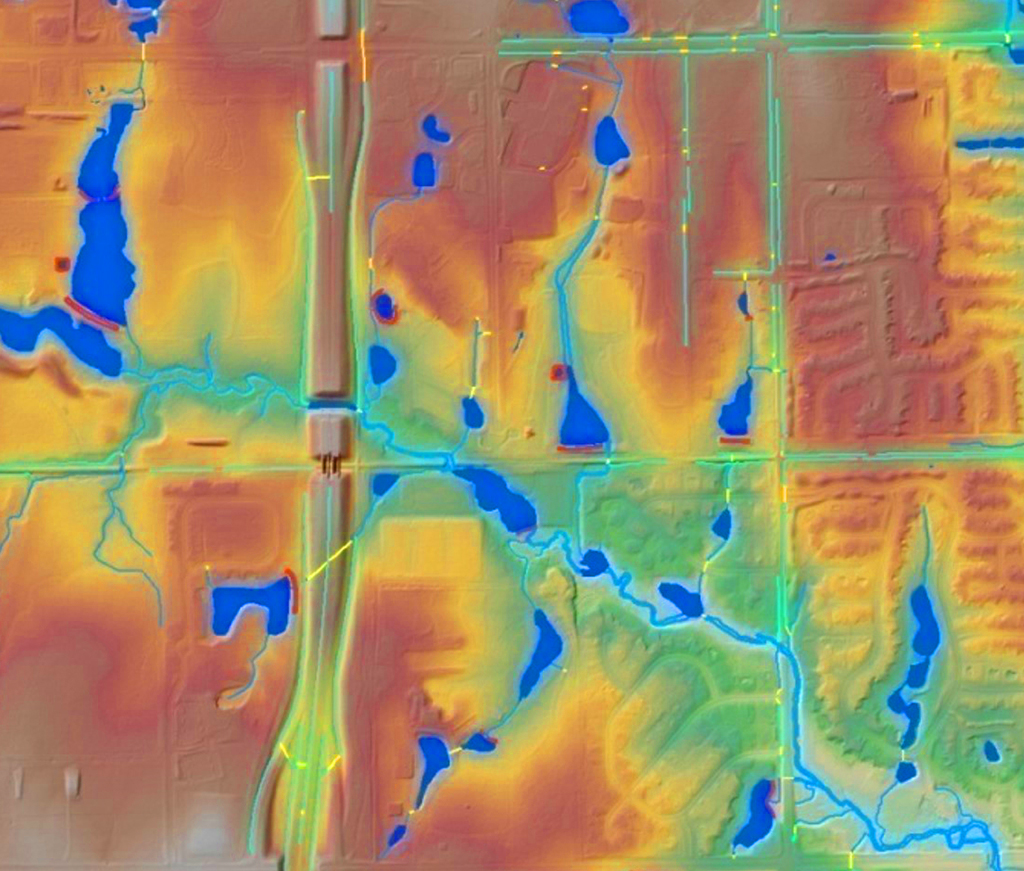
Lidar Data Capture and Processing
![]()
Hyperspectral Imagery Capture, Processing, and Analysis
![]()
Terrestrial High-Density Scanning
Expert Dataset Creation, Processing, and Management
Our innovative dataset creation, processing, and management services provide you with a complete picture of your data. We can develop customized applications tailored to you, so your data is always accessible and usable. We’ll also help you navigate the complexities of distributing GIS data to user groups and stakeholders. We think beyond traditional delivery mehtods to help you make the best data-derived decisions possible. Our GIS services include:
- Field Feature and Attribute Collection and Audits
- GIS Database Audits
- GIS Staff Augmentation
- Corridor Mapping and Routing Methodology
Facility Scanning
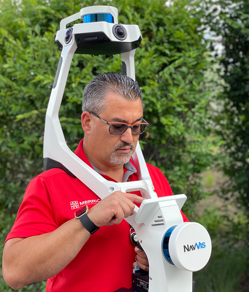
We use industry-leading instruments for 3D mapping and facility scanning to provide you with invaluable tools like digital twins of your facility that can be leveraged during the planning of your project. Using equipment like wearable (mobile) lidar scanners, our lidar technicians and survey professionals scan facility as-builts with speed and precision. We use the data collected to provide you with 360° virtual tours, point clouds, and programmed meta-data for your facility. We still use traditional tools like static laser scanners, total stations, digital levels, and GNSS/GPS receivers when high levels of precision are required. However, these traditional methods are time-consuming. We can use mobile lidar scanning to provide you with data with +/- 1.5 inches of accuracy in a much shorter time frame than traditional tools.
Cutting-Edge Technology
As employee owners, we invest in the most advanced lidar sensors on the market, so we can offer you cutting edge data solutions. We’re one of the first commercial geospatial firms in North America to offer a simultaneous, multi-sensor data collection system featuring lidar, a hyperspectral sensor, and a digital camera. We also use an unmanned aerial system to cost-effectively gather information in smaller areas.
Software and Products
Our experts have created several software products available for download that will help you visualize, manage, process, and analyze lidar point cloud data. Our proprietary MARS® software was developed through our extensive experience with cutting-edge geospatial solutions. We’re also a licensed distributor for the Euclideon Geoverse software suite.

Geospatial Work in Texas
TX-DIR-CPO-4502 MERRICK & COMPANY
Merrick holds a Texas Department of Information Resources (TX-DIR) contract to provide geospatial services. This cooperative purchasing contract provides substantial pricing discounts to offer Texas state agencies and political subdivisions the most cost-effective information resources. All governmental entities in Texas are eligible, including state agencies, universities, and political subdivisions. Public entities outside of Texas also may be eligible to use this contract.
To obtain quotes, place purchase orders, or for more information about the Merrick & Company DIR-CPO-4502, contact us at 303-353-3901.
![]()